

Preview
Date
Spring 5-1985
Description
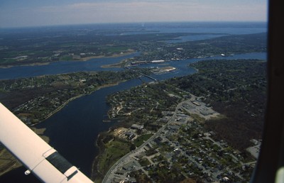
East Providence is a long, narrow, zigzag-shaped town squeezed between the Seekonk River to the west and, to the east, the Ten Mile and Runnins rivers, Barrington has the highest per capita income of any town in the state. The architectural pilgrim who expects from this a precinct of walled estates and grand mansions, however, will be disappointed by the low-key quality of the place overall. They cluster mostly along Narragansett Bay, and especially along Rumstick Road, which takes its name from the neck that separates the mouth of the Warren River from the bay. Yet attractive as many of these houses are, Barrington’s wealthiest clients seem to have played it safe in choosing architects, apparently wanting reassurance more than showiness or distinction.
Rights
This object from the Chester E. Smolski photographic slides and publications, housed by the Rhode Island College Special Collections, and any of its digital surrogates are the intellectual property of Rhode Island College. This digital object is protected by copyright and/or related rights. The digital material presented here is licensed with a Creative Commons Attribution-NonCommercial-ShareAlike 4.0 International License. This content can be used, shared, or adapted for educational and scholarly purposes. For permissions to use this item please contact digitalcommons@ric.edu. All uses must include appropriate attribution.
Creator 1 Role
Photographer
Recommended Citation
Chester E. Smolski photographic slides and publications, MSS-0041, Special Collections, James P. Adams Library, Rhode Island College.
Recommended Citation
Chester E. Smolski photographic slides and publications, MSS-0041, Special Collections, James P. Adams Library, Rhode Island College.
Keywords
aerial; Newport;
Notes
William H. Jordy, Buildings of Rhode Island, (s.l, 2004) p. 433;446.