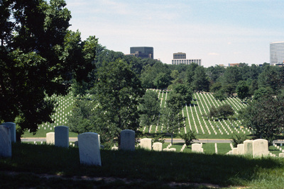
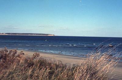
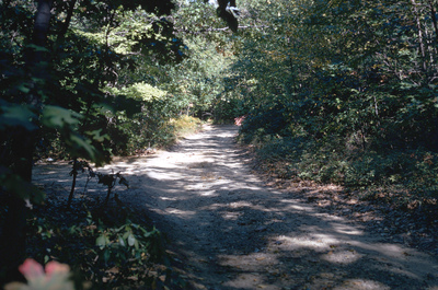
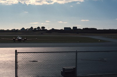
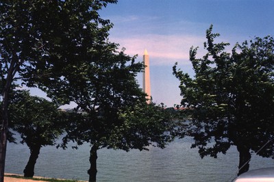
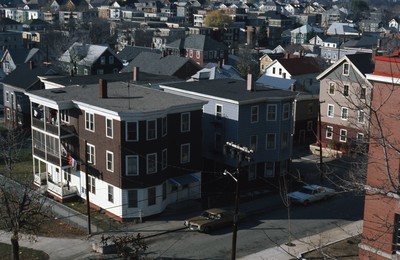
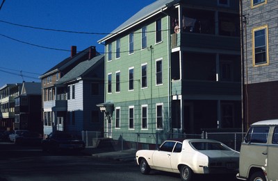
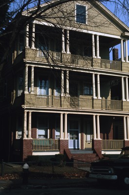
Digital Commons @ RIC
  • My Account
  • FAQ
  • About
  • Home

Digital Commons @ RIC

Home > Special Collections > Smolski Collection > Smolski Images

Smolski Collection

Smolski Images

Rhode Island College Professor Chester Smolski retired in 1994 after a successful 41 year career at the college. Professor Smolski co-developed and coordinated the Rhode Island Geographic Education Alliance, a project of the National Geographic Society, and was an acknowledged expert on urban geography, urban history and city planning. He contributed over 370 columns for The Providence Journal and Providence Business News.

In 2009, the Smolski family donated almost 6000 slides and 370 Op-Ed columns to the James P. Adams Library permanent collection at Rhode Island College. Both the slides and the Op-Ed columns are authored by Professor Smolski. They reflect the international nature of his research and his commitment to using that work to inform public discussion on Rhode Island's place in history and the world. The Adams Library has committed itself to maintain this outstanding collection and to place the Smolski Collection on its Digital Commons because of its educational value for urban studies, geography, architectural history and city planning.

The digitization of this collection is supported in part by a grant from the Rhode Island Council for the Humanities and with financial support from the Smolski family.

Printing is not supported at the primary Gallery Thumbnail page. Please first navigate to a specific Image before printing.

Follow

Switch View View Slideshow
  • Blackstone River: South View from Court St. Bridge
  • East Providence: Waste Water Treatment Facility, Pomham Lighthouse
  • Madison: Truax Barracks Public Housing, Construction
  • View of Downtown Woonsocket from Court Street Bridge
  • Woonsocket: City Hall
  • Woonsocket: Depot Square
  • Woonsocket: St. Germain Manor, Elderly Housing
  • Woonsocket Village
  • Woonsocket Village, Urban Renewal
  • Woonsocket: Urban Renewal Social Flatlands
  • Woonsocket Village & Marquette Building
  • Skärholmen: Million Programme Housing
  • Skärholmen: Million Programme Housing, Cycle Paths
  • Stolkholm: Skärholmmen Apartments and Gardens
  • Charleston: Pink House on Chalmers St
  • 1978 Neighborhood Map
  • 282 Doyle Ave.
  • Abandoned house for sale
  • Aerial of State House and Downtown Providence
  • Arcade-Market Support for Specialty Center
  • Arcade-Providence DT parking near Arcade
  • Arlington National Cemetery
  • Beach on Block Island
  • Blackstone Park on Seekonk River- Providence
  • Block Island Airport
  • Block Island City Drug Store
  • Block Island Docks
  • Block Island Fountain Square
  • Block Island statue and City Drug Store
  • Boston: Skyline from John F. Kennedy Presidential Library
  • Bristol 4th of July Parade
  • Canon Beach: Seaside
  • Canteburry Apartments: Rt. 44; Tauton 72 Units
  • Central and Classical H.S. Area
  • Charles A. Hopkins House
  • Cincinnati: Downtown Aerial, Chiquita Center (Columbia Plazza), Fifth Third Center
  • Columbia Mall Aerial
  • Columbia: Seven Eleven,  Retail
  • Columbia: Walkways, Park
  • Columbia: Walkways, Public Pool
  • Coventry: Old Coventry Cathedral, Wooden Cross, Cross of Nails
  • Faneuil Hall Aerial at Night
  • Faneuil Hall Aerial at Night
  • Faulkner Ridge - Columbia, Maryland
  • Fisherman’s Memorial - Land’s End
  • George Washington Monument
  • Gloucester- Prospect St. Housing
  • Grave of Robert F. Kennedy
  • Hirshhorn Museum
  • Hirshhorn Museum
  • Housing Apartments: 72 Units
  • India Point Park
  • Iowa: Aerial Photograph
  • Jerusalem: Simoni Cyrenato Crux Imponitur, Via Dolorosa
  • Jerusalem: Truck Chasis from 1948 War on Roadside
  • John F. Kennedy Eternal Flame
  • John F. Kennedy Eternal Flame
  • Lake Kittamaqundi and the “People Tree” Sculpture
  • Litchfield - Old Housing in the Fall
  • Mill Owner’s House- Burriville
  • Mobile Home in Individual Site, Glocester, RI
  • Morgantown: Seneca Glass Company (Factory Interior)
  • Moshassuck Arcade
  • NE Map - Mobile Home Location and Rules
  • NE Map- mobile homes location and regulations 2
  • Newport- Salve Regina poorly attended grounds but lovely building
  • New Shoreham House on Block Island
  • New York City: Northeast Population Map
  • Norfolk: Aerial, North Corner
  • Norfolk: Commercial Park
  • Norfolk: Elizabeth River Ferry
  • Norfolk: Parking Garage for Waterside Festival Marketplace
  • Norfolk: Waterside Festival Marketplace
  • Old State Capitol- North Main Street, Providence
  • Parade St. (Before)
  • Pawtucket Slater Mill
  • Providence - Historic East Side
  • Providence Housing- lower income
  • Providence India Point Park looking East
  • Providence Land Use Map
  • Providence Map
  • Providence Map Interface
  • Providence Map: Plan for green space and parking
  • Providence Map: Plan of Interface
  • Providence Redevelopment Map
  • Providence Turk’s Head Building
  • RI Map- mobile homes and rules of regulation
  • Robert F. Kennedy Grave Marker
  • Roger Williams Park, Japanese Garden
  • Soldier and Officer
  • Southern NE Map- mobile homes and regulations
  • South Providence 235 Housing CURE
  • South Providence - Comstock Ave.
  • Stevenage: Birth & Death Rates
  • Stevenage: Town Center Map
  • Tall Ships at Newport
  • The Hope Diamond
  • The Mall in Columbia - Columbia, Maryland
  • The “People Tree” Sculpture
  • The Rouse Company - Columbia, Maryland
  • The Smithsonian Institute
  • The Washington Monument
  • Triple-decker
  • Triple-decker Houses in Central Falls
  • Triple-Deckers Douglas Avenue - Providence
  • Triple-Deckers Eaton St
  • Triple-Decker Showboat- Central Falls
  • Triple-Deckers on Eaton St.
  • Triple-deckers; one in back of garden
  • Trustrum Dodge Memorial - Block Island
  • Trustrum Dodge Memorial- Block Island
  • View of docks on Block Island
  • View of Downtown Providence from Prospect Terrace Park
  • View of Providence East Side from State Street & a view of the Cathedral of St. John
  • Washington, DC: Trompe l’Oeil Wall Mural
  • Washington Monument at Night
  • Westerly- Weekapaug Beach
  • White House Tourists
  • San Francisco: Ghiradelli Fountain
  • San Francisco: Ghiradelli Square, Mermaid Fountain
  • Mexico City - Palacio de Bellas Artes
  • Providence- 1st Baptist Church from Tower
  • First Baptist Church
  • Boston: South End
  • Boston: South End
  • Boston: South End, Brick Sidewalk
  • Boston: South End, Side Street
  • Vietnam Veterans Memorial Wall
  • Norfolk: Confederate Monument, Commercial Place
  • San Francisco: Ghiradelli Square
  • Kings Chapel - Boston
  • The Three Servicemen Statue
  • Boston City Hall
  • Rehovot: Memorial to the Holocaust at the Weizmann Institute of Science
  • State House
  • Rosecliff
  • Rosecliff Mansion
  • Nofolk: Scope Arena (Norfolk Scope)
  • Norfolk: Scope Arena
  • Boston: Quincy Market
  • Radburn: Howard Ave & Brearly Crescent
  • Radburn: Walkways and Public Parks
  • Providence Industrial National Architectural Detail- Union Trust Co Building
  • Cranston St. Armory
  • Rosecliff Garden
  • Canon Beach: Coastal Orgeon
  • Canon Beach: Wind Swept Trees
  • 1975 Housing Conditions (Map)
  • Aerial of Providence River looking north toward the city
  • Blacks as percent of census Providence-1980
  • Census Regions & Divisions of the U.S.
  • Davol Square Shopping Center
  • Davol Square Shopping Center - Interior
  • Davol Square Shopping Mall (Interior)
  • Downtown Providence - Cathedral Square and I-95
  • Hand-drawn map of downtown Providence
  • Interface: Providence - Activity Generators Map
  • Map of Providence neighborhoods
  • Map - Providence neighborhoods and highways
  • Providence births out of wedlock,1980
  • Providence Black Population - 1980
  • Providence Median Age by Census - 1980
  • Providence Owner Occupied Housing Rates-1980
  • Providence population by Census Tract - 1980
  • Providence Skyline
  • Providence Skyline from new development in Capital Center
  • Providence Spanish Origin Population -1980
  • Renter Occupied Housing Units 1980 - Providence
  • Rhode Island State House and Providence Station
  • River Relocation Construction
  • Rt. I- 195 W in Providence, 1990(?)
  • Triple-Deckers on Eaton St.
  • View of downtown Providence from Prospect Terrace Park
  • Bandstand at the Casino (Roger Williams Park)
  • The Bandstand behind the Casino at Roger Williams Park, Providence
  • Painting - “Providence From Across the Cove” (1818) - Alvan Fisher
  • Providence Neighborhoods - Map
  • Rhode Island State House from Prospect Terrace Park
  • Rhode Island State House from Prospect Terrace Park
  • Union Trust Company Building
  • Conrad Building
  • Interior of Providence Train Station
  • Woonasquatucket River looking west toward Waterplace Park
  • View of Old Stone Federal Savings Bank and First Unitarian Church on the East Side Custom House Street, Providence
  • Providence
  • Providence
  • Providence
  • Providence
  • Arlington: Marine Corps War Memorial
  • Arlington: Marine Corps War Memorial
  • Aerial View of Kennedy Plaza and Burnside Park
  • Cincinnati: Aerial, North View (Macy’s Inc, Covenant First Presbyterian Church)
  • Cincinnati: Covenant First Presbyterian Church
  • Cincinnati: Hyatt Regency Cincinnati, High Rise
  • Cincinnati: Riverfront Stadium (Cinergy Field)
  • Lexington: Gainesway Farm Entrance
  • Norfolk: Waterside Festival Marketplace, Interior
  • Union Station, Waterplace Park, and Rhode Island State House from Biltmore Hotel
  • Cincinnati: City Hall
  • Lexington: Ashland (Henry Clay Estate)
  • Lexington: Thoroughbred Park
  • Lexington: Thoroughbred Park
  • Cincinnati: Fountain Sqaure
  • View of Kennedy Plaza, Burnside Park & Financial District
  • Welcome to Providence “Safest City” Sign on Providence Biltmore Hotel
  • Cincinnati: Isaac M. Wise Temple (Plum Street Temple)
  • Albuquerque: Old Town
  • Albuquerque: Rio Grande Aerial
  • Chicago: Aerial, Lake Shore Drive, North Side
  • Chicago: Downtown, Aerial
  • Chicago: O’Hare, North
  • Construction on Memorial Blvd. Looking South from One Citizens Plaza at the Confluence of the Moshassuck and Woonasquatucket Rivers
  • Indianapolis: Crowne Plaza Hotel at Indianapolis Union Station, Interior
  • Indianapolis: Indiana Avenue Apartments
  • Indianapolis: IUPUI Campus, Indiana; University Place Hotel
  • Indianapolis: Market Square Arena
  • Indianapolis: One America Tower from State Capitol
  • Indianapolis: One America Tower, Skyline from Chase Tower
  • Indianapolis: Skyline from IUPUI
  • Indianapolis: Skyline from New York Street
  • Indianapolis: Soldiers’ and Sailors’ Monument
  • Indianapolis: White River State Park
  • Indianapolis: White River State Park, Central Canal
  • Loretto Chapel: Mysterious Staircase
  • New Mexico: Caballo Dam
  • New Mexico: Dam Rio Grande
  • New Mexico: San Felipe Indian Reservation
  • Rio Grande Dam
  • View of Center Place & Rhode Island State House
  • Alburquerque: New Town Center
  • Indianapolis: State House
  • Indianapolis: State House
  • Indianapolis: Union Station and Pan America Plaza
  • Catedral Santa Maria la Menor
  • New York Skyline
  • Santo Domingo Aerial
  • Census Map of U.S. 1980-1990
  • East Providence: Aerial
  • Norfolk: City Hall, MacArthur Memorial
  • North Carolina: Adopt a Highway
  • Seekonk: Aerial, Strip Mall Development on Route Six
  • Warren/Barrington: Aerial Photograph
  • Baltimore: Basilica of the National Shrine of the Assumption of the Blessed Virgin Mary
  • Rosecliff  Mansion Plaque
  • Baltimore: Cross Street Market
  • Baltimore: Cross Street Market Interior
  • Baltimore: Cross Street Market Interior
  • Baltimore: Row House Architecture
  • Baltimore Row Houses
  • Normandy American Cemetery and Memorial
  • Baltimore: Mount Vernon Place
  • Mount Vernon Place
  • Rhode Island State House & Hispanic America at Rhode Island Heritage Festival
  • University of Colorado - Boulder
  • St Louis: Gateway Arch, Gateway One Building
  • Aerial of Blighted Upper South Providence
  • Aerial of Financial District looking east
  • Aerial of fire-damaged Union Station and Capital Center redevelopment in progress.
  • Aerial of Interstate 95 at downtown Providence
  • Aerial View of Providence Capital Center with New Train Station
  • Aerial View of Providence Station and Environs
  • Aerial View of Weybosset Hill and Cathedral Square - Urban Renewal
  • Armory District - Cranston St., Providence
  • Boston: Skyline from Kennedy Library
  • Capital Center before transformation
  • Future Site of Rhode Island Convention Center and Westin Hotel and Residences
  • Portland, Maine
  • Portland, Maine
  • Providence Station and Rhode Island State House looking west at dusk
  • Richard Oscar Burgess House (The “Crayola” House)
  • The Transformation of Capital Center
  • Union Station damaged by fire and excavations to the north
  • Aerial of Rhode Island State House (1895-1904) & Foundation of Providence Station (1982-1986)
  • Boston: John F. Kennedy Presidential Library and Museum
  • Boston: John F. Kennedy Presidential Library Pavilion, Interior
  • Boston: Kennedy Presidential Library and Museum
  • Union Station Fire Damage from the Providence Biltmore Hotel
  • Aerial of Cranston Street Armory
  • Providence Station and Rhode Island State House
  • Aerial of a Planned Community
  • Aerial of Downtown Providence
  • Aerial of Elmhurst and Wansuck neighborhoods
  • Aerial of Newport Harbor
  • Aerial of Providence over Seekonk River
  • Aerial View of Downtown Providence
  • Aerial view of highways
  • Aerial View of Middleton
  • Aerial View of Newport
  • Aerial View of North Burial Ground, North Main St.
  • Aerial View of RI Company Powerhouse also known as Manchester St. Power Station
  • Baltimore Aquarium
  • Baltimore: Inner Harbor Plaza
  • Baltimore: National Aquarium, Inner Harbor
  • Baltimore: National Aquarium, inner Harbor
  • Baltimore: USS Constellation
  • East Providence- Barrington Aerial View
  • Hartford Ave. Public Housing
  • Huntington Industrial Park
  • Norfolk: Confederate Monument, Downtown, Commercial Park
  • Norfolk: Granby Mall
  • Norfolk: Granby Mall
  • Norfolk: Loew’s Theater, Trolly
  • Norfolk: New Spirit, Hampton Roads, Harbor
  • Norfolk: Public Art, Wall Mural, Parking Lot
  • Norfolk: St Paul’s Blvd, The Basilica of St Mary of the Immaculate Conception Church
  • Norfolk: Waterside, Bank of America Center
  • Old Stone Square on South Main Street
  • Olneyville & Hartford Park
  • Planned Community
  • Providence Detail
  • Providence East Side-Brown
  • Reston: United States Geological Survey
  • Roger Williams Park in South Elmwood
  • State Capitol
  • Aerial View of Roger Williams Park
  • Norfolk: Confederate Monument, Bank of America Center,
  • Aerial of Rhode Island State House and Train Station
  • Baltimore: Inner Harbor, USS Constellation, Aerial
  • Baltimore: Harborplace Mall Light Street Pavilion
  • CCE URI Providence and Construction of Providence Train Station
  • Providence Water Front: India Point Park
  • Aerial of downtown Providence looking east
  • Aerial of Financial District looking south
  • Aerial of I-195 and Manchester Street Station
  • Aerial View of Fields Point in Washington Park, Providence
  • Biltmore Hotel and Downtown Providence
  • Burlington: Burlington Square Mall
  • Burlington: Burlington Square Mall (Burlington Town Center, Church Street Marketplace)
  • Burlington: Burlington Square Mall (Church Street Marketplace)
  • Burlington: Burlington Square Mall (Church Street Marketplace)
  • Burlington: Burlington Square Mall (Church Street Marketplace, Burlington Town Center)
  • Cianci Inauguration
  • Columbia: Bryant Woods Elementary School
  • Downtown Providence from Point St. Bridge
  • I-95, Providence Civic Center, and view of Capital Center before redevelopment
  • Moved House on Benefit Street
  • Port of Providence just south of Collier Park
  • Providence Primary Metropolitan Statistical Area (PMSA)
  • Rhode Island State House & Government Offices on Smith St.
  • Vermont: Burlington Square Mall (Church Street Marketplace, Burlington Town Center), Masonic Temple Building
  • Burlington: Burlington Square Mall (Church Street Marketplace), First Unitarian Church, Masonic Temple
  • Aerial View of the Capitol
  • Clarksburg: U.S. Rt 50 West, Joyce St. Exit
  • Morgantown: High St.
  • Morgantown: High St., Rt 119 South
  • Morgantown: Housing, Seneca Glass Company
  • Morgantown: Monongahela River
  • Morgantown: Personal Rapid Transit
  • Morgantown: Personal Rapid Transit (Station, Cars)
  • Morgantown: Personal Rapid Transit (Station Platform)
  • Morgantown: Personal Rapid Transit System
  • Morgantown: Personal Rapid Transit System
  • Morgantown: Personal Rapid Transportation (Station)
  • Morgantown: Seneca Glass Company (Factory Interior)
  • Morgantown: Seneca Glass Company (Factory Worker)
  • Morgantown: Seneca Glass Company (Factory Worker)
  • Morgantown: West Virginia University, Downtown Campus
  • Morgantown: West Virginia University Evansdale Campus, Personal Rapid Transit Station
  • Tel Aviv: Airport (Ben Gurion)
  • Tel Aviv: Housing & Setting Sun
  • Bethlehem : Church of the Nativity
  • Bethlehem: Statue of Saint Hieronymous (Jerome) at Church of St. Catherine of Alexandria
  • Dead Sea: Sea Level Marker
  • East Jerusalem: Mount of Olives Jewish Cemetary
  • Hereford: Entry in Wales
  • India Point Park River
  • Jaffa: Flea Market
  • Jaffa: St. Peter’s Church
  • Jerusale: Eastern Wall toward Mt. of Olives
  • Jerusalem: al’Aqsa Mosque
  • Jerusalem: al’Aqsa Mosque, View from the Dome of the Rock
  • Jerusalem: al’Aqsa Mosque, View from the Dome of the Rock
  • Jerusalem: Chruch of the Holy Sepulchre
  • Jerusalem: Church of the Holy Sepulchre
  • Jerusalem: Church of the Holy Sepulchre (Detail)
  • Jerusalem: Church of the Holy Sepulchre Interior
  • Jerusalem: Dome of the Ascension & Archways on the Dome of the Rock Platform
  • Jerusalem: Dome of the Rock
  • Jerusalem: Dome of the Rock
  • Jerusalem: Dome of the Rock
  • Jerusalem: Dome of the Rock
  • Jerusalem: Dome of the Rock
  • Jerusalem: Dome of the Rock
  • Jerusalem: Dome of the Rock, Exterior Detail
  • Jerusalem: Dome of the Rock Outer Wall Facade
  • Jerusalem: Dung Gate
  • Jerusalem: Hurva Synagogue Ruins
  • Jerusalem: Israel Museum, Sculpture, Shrine of the Book
  • Jerusalem: Kidron Valley, Absalom’s Pillar
  • Jerusalem: Mount of Olives
  • Jerusalem: New City
  • Jerusalem: New City inside Dung Gate
  • Jerusalem: Old City Alleyway
  • Jerusalem: Old City Market
  • Jerusalem: Old City Market
  • Jerusalem: Old City Market
  • Jerusalem: Old City, South Wall
  • Jerusalem: Old City, South Wall (detail)
  • Jerusalem: Part of St. Stephen’s Gate
  • Jerusalem: Phasael Tower (detail)
  • Jerusalem: Phasael Tower, Old City
  • Jerusalem: Ruins & Mt. of Olives
  • Jerusalem: Southeast End of the Eastern Wall
  • Jerusalem: South Wall
  • Jerusalem: Street Scene at Jaffa Gate
  • Jerusalem: The Mount of Olives (Landscape)
  • Jerusalem: The Noble Sanctuary
  • Jerusalem: The Noble Sanctuary
  • Jerusalem: The Noble Sanctuary
  • Jerusalem: The Noble Sanctuary and al’Aqsa Mosque
  • Jerusalem: The Wailing Wall at the Noble Sanctuary
  • Jerusalem: The Western Wall
  • Jerusalem: Tomb of Bene Hezir and Tomb of Zechariah
  • Jerusalem: Tourists at the Dome of the Rock
  • Jerusalem: Troops at Jaffa Gate
  • Jerusalem: Via Dolorosa
  • Jerusalem: Western Wall
  • Jerusalem: Western Wall
  • Jerusalem: Western Wall
  • Jerusalem: Western Wall, al’Aqsa Mosque, and the Dome of the Rock
  • Map of People of Spanish Origin as Percent of Census Tract 1980- Providence
  • Masada
  • Masada: Cable Car Access
  • Masada: Natural Fortress, Ruins, Visitors
  • Masada: Roman Road (2 of 2)
  • Masada: Roman Siege Camp Ruins
  • Masada: Roman Siege Camps
  • Masada: Roman Style Tile & Bath
  • Masada: Ruins of Herod’s Palace
  • Masada: Ruins, View From Top
  • Masada: Tourists and Ruins
  • Masada: View from the top (1 of 2)
  • Masada: View from the top (2 of 2)
  • Masada: View Toward Dead Sea
  • Massada: Roman Road (1 of 2)
  • Massada: Tiles in Herod’s Palace
  • Paris: Charles DeGaulle Airport
  • Qumran: Caves where the Dead Sea Scrolls were Discovered
  • Qumran: Location of Dead Sea Scrolls, Cave 4
  • Qumran: Water Channel ad Cave Entrance, Dead Sea Scrolls Area
  • Rehovot: Main Gate at the Weizmann Institute of Science
  • Rehovot: Weizmann House
  • Senghenydd: Housing
  • Tel Aviv: Aerial (1 of 6)
  • Tel Aviv: Aerial (2 of 6)
  • Tel Aviv: Aerial (5 of 6)
  • Tel Aviv: Aerial (6 of 6)
  • Tel Aviv: Allenby Street
  • Tel Aviv: Allenby St. street signs
  • Tel Aviv: Beach
  • Tel Aviv: Beach
  • Tel Aviv: Beaches, Tourism
  • Tel Aviv: Bus Stop on Allenby Street
  • Tel Aviv: Carmel Market
  • Tel Aviv: Carmel Market
  • Tel Aviv: Carmel Market, Allenby Street
  • Tel Aviv: Carmel Market Butcher
  • Tel Aviv: Carmel Market “Shuk Ha’Carmel”
  • Tel Aviv: Chanky Beach
  • Tel Aviv: Coastline
  • Tel Aviv: Coastline Hotels, Miami of the Middle East
  • Tel Aviv: Construction at Tel Aviv University
  • Tel Aviv: Dizengoff St.
  • Tel Aviv: Dizengoff Street
  • Tel Aviv: Dizengoff Street
  • Tel Aviv: Dizengoff Street on the Shabbat
  • Tel Aviv: Dizengoff St. Retail
  • Tel Aviv: Fence for Security around Tel Aviv University
  • Tel Aviv: Housing
  • Tel Aviv: Housing
  • Tel Aviv: Housing, Bauhaus
  • Tel Aviv: Metzudat Ze’ev (also known as Beit Jabotinsky) & Tel Aviv City Hall
  • Tel Aviv: Residential Street
  • Tel Aviv: Tel Aviv Marina
  • Tel Aviv University: Dormitories
  • Tel Aviv University: Entrance
  • Jerusalem: Basilica of the Agony/The Church of All Nations and the Church of Saint Mary Magdalene
  • Jerusalem: Shrine of the Book
  • Jerusalem: Shrine of the Book
  • Jaffa: Hassan Bek Mosque
  • Tel Aviv: City Hall
  • Tel Aviv: City Hall & Rabin Square
  • Tel Aviv: City Hall & Rabin Square Fountain
  • Tel Aviv: City Hall, Machei Israel Square (now Rabin Square)
  • Tel Aviv: Aerial (3 of 6) - City Hall at Rabin Square, Former I.B.M Building
  • Tel Aviv: International Style in Residential Architecture
  • Tel Aviv: Urban Greenery, Residential Neighborhood
  • Tel Aviv: Former I.B.M Building, Cityscape (Weizmann Branch)
  • Jerusalem: Eastern Wall, Jewish Cemetery, Church of Mary Magdalene
  • Tel Aviv: Beit Hatfutsot
  • Tel Aviv: University, Diaspora Museum
  • Tel Aviv: Beit Hatfutsot, Soldiers
  • Rehovot: Koffler Accelerator at the Weizmann Institute of Science
  • Rehovot: Memorial to the Holocaust at the Weizmann Institute of Science
  • Rehovot: Memorial to the Holocaust Plaza at the Weizmann Institute of Science
  • Rehovot: Memorial to the Holocaust Plaza at the Weizmann Institute of Science
  • Tel Aviv: Great Synagogue on Allenby Road
  • Rehovot: Weizmann House
  • Tel Aviv University: Sourasky Central Library
  • Bat Yam: Town Hall
  • Tel Aviv: Housing & Shalom Tower
  • Tel Aviv: Atarim Plaza
  • Tel Aviv: Atarim Square
  • Tel Aviv: Machei Israel Square, City Hall
  • Westminster Street end of the Providence Arcade
  • Tel Aviv: Bust of David Ben-Gurion in Airport
  • Tel Aviv: Dizengoff Shopping Mall
  • Tel Aviv: Dizengoff Center
  • Tel Aviv: Dizengoff Center
  • Tel Aviv: Machei Israel Square, Modernist Housing
  • Tel Aviv: Aerial (4 of 6), Former I.B.M. Building
  • Rehovot: Chaim and Vera Weizmann Grave
  • Aerial View of Quonset Point
  • Boston - Waterfront and Downtown
  • France: Honfluer
  • Lafayette Park - Washington D.C.
  • Pennsylvania Avenue - Washington D.C.
  • Radburn: Walkways, Pedestrian Traffic
  • Washington Circle - Washington D.C.
  • Radburn: Parks, Planned Community
  • Radburn: Pedestrian Roads
  • Radburn: Planned Community Baseball Field
  • Downtown parking north of rail lines
  • Providence East Side 1840s Row Housing-Athenaeum Row
  • Aerial view of Warwick and Rhode Island Malls
  • Arlington National Cemetery
  • Baltimore: Federal Hill, Museum of Science, Inner Harbor
  • Baltimore: Inner Harbor, Docks
  • Baltimore: Inner Harbor, Maryland Science Center
  • Baltimore: Row Houses
  • Baltimore: Row Housing
  • Baltimore: Row Housing
  • Baltimore: Row Housing
  • Baltimore: Skyline, Tower Building, City Hall
  • Baltimore: USS Constellation, Inner Harbor
  • Baltimore: USS Constellation; Old Harry Ship and McCormick Spice Factory
  • Blackstone Falls
  • Blackstone Falls Site
  • Blackstone Falls Site
  • Blackstone Falls Site
  • Blackstone Falls Site
  • Charleston: Aerial View of “The Citadel: Military College of South Carolina”
  • Charleston: Fort Sumter Aerial Photograph
  • Charleston: Hampton Park
  • Charleston: Highway 26 Interchange with U.S. 17
  • Charleston: Housing
  • Charleston: Housing, Charleston International Airport, Aerial
  • Charleston: Hyman’s Wholesale Co. Parking Garage
  • Charleston: Marion Square
  • Charleston: Naval Base
  • Charleston: Porgy & Bess
  • Charleston: Rainbow Row
  • Charleston: Suburb Neighborhood
  • Charleston: The Citadel: Military College of South Carolina
  • Columbia Mall
  • Disney World: Buena Vista Info Center
  • Disney World: Disney World Village
  • Disney World: Frontierland, Mike Fink Keel Boats
  • Disney World: Liberty Square Riverboat
  • Disney World: Main Street Railroad Station
  • Disney World: Main Street USA in the Magic Kingdom
  • Disney World: Sir Edward’s Haberdashery
  • Disney World: The Empress Lilly
  • Everglades: Mangrove Forest in a Sawgrass Marsh
  • Everglades: Mangrove Tree
  • Everglades: Native Wildlife
  • Everglades: Nesting Roseate Spoonbills
  • Florida: Aerial of Downtown Tampa (1 of 3)
  • Florida: Aerial of Downtown Tampa (2 of 3)
  • Florida: Aerial of Downtown Tampa (3 of 3)
  • Florida: Citizens Bank Building in Tampa
  • Florida: Clearwater Beach and Pier 60
  • Florida: Clearwater Entertainment Limbo
  • Florida: Columbia Restaurant in Ybor City
  • Florida: Downtown Saint Petersburg & Mirror Lake
  • Florida: Downtown St. Petersburg
  • Florida: Downtown Ybor City
  • Florida: Everglades National Park
  • Florida: “Finger" Island Housing Developments
  • Florida: Finger Islands in St. Petersburg
  • Florida: Franklin Exchange Building in Tampa
  • Florida: Hillsborough River in Tampa
  • Florida: Howard Frankland Bridge (Causeway #275)
  • Florida: Mirror Lake
  • Florida: Publix Super Markets, Inc.
  • Florida: St. Petersburg Housing
  • Florida: St. Petersburg’s Central Business District
  • Florida: Tin City in South Naples
  • Florida: View from St. Petersburg to Tampa
  • Florida: World War Heroes Memorial in Williams Park  St. Petersburg, FL
  • Florida: Worth Avenue in Palm Beach
  • Florida: Ybor City 7th Avenue
  • Georgia: The Westin Peachtree Plaza, Atlanta
  • Industrial Man
  • Iwo Jima Memorial
  • Key Biscayne, Miami: Aerial Photo
  • Marine Corps War Memorial
  • Marine Monument Iwo Jima
  • Marine Monument Iwo Jima
  • Miami: Aerial, Residential, Interstate 95
  • Miami Beach: Aerial Photograph, Oceanfront Looking North
  • Miami Beach: Aerial Photograph of Oceanfront, Hotels
  • Miami Beach: Aerial View of Bal Harbour, Collins Ave.
  • Miami Beach: Aerial View of Residential Area
  • Miami Beach: Bal Harbour
  • Miami Beach: Bal Harbour
  • Miami Beach: Bal Harbour Area
  • Miami Beach: Biscayne Point
  • Miami Beach: Residential
  • Miami: Beach Scene at Key Biscayne
  • Miami: Beach Scene at Key Biscayne
  • Miami Beach: South Beach, Aerial
  • Miami Beach: South Beach Aerial View
  • Miami Beach: Versailles Hotel Condo, Jamie Tuttle Causeway; Aerial View
  • Miami: Cuban Culture in Downtown Miami
  • Miami: Downtown, East Flagler Street
  • Miami: Industrial Park, Aerial
  • Miami: Interstate 95
  • Miami: Jewelry District, Downtown
  • Miami: Little Havana, SW 8th St.
  • Miami: Little Havana, SW 8th Street
  • Miami: South District Wastewater Treatment Plant
  • Miami: The Miami Seaquarium
  • Miami: Traffic Lights, Miami Avenue and Flagler Street
  • Miami: Vest Pocket Park
  • New Orleans: Bourbon Street at Mardi Gras
  • North Charleston: Industry
  • Orlando: Walt Disney World Resort
  • Parris Island Auditorium
  • Parris Island, South Carolina
  • Pier Village Apartments
  • Pier Village Directory
  • Pier Village, Narragansett, RI
  • Plaque: Senator Paul H. Douglas
  • Port of Providence
  • Progress Energy Baseball Park - St. Petersburg, FL
  • Providence Downtown and CVS Facade
  • Providence Downtown- Old Rhode Island College
  • Providence Downtown Washington Street
  • Providence Nov. 11 1978 Veteran’s Day
  • Providence Nov. 11 1978 Veteran’s Day
  • Slater Mill Built 1793- First US Textile Mill
  • Smithsonian - Columbia
  • Smithsonian - Spirit of St. Louis
  • Spa Beach: St. Petersburg, Florida
  • State House
  • St. Petersburg Housing Development - Florida
  • St. Petersburg Sunshine Skyway Bridge: St. Petersburg, FL
  • St. Pete’s Meadowlawn Housing
  • St. Pete's Sinkhole
  • The Everglades: Camp Ground
  • The Everglades: Sawgrass Prairie
  • University of Miami Coral Gables Campus
  • University of Miami Coral Gables Campus: Food Court, Resident Halls
  • University of Miami Coral Gables Campus: Swimming Pool
  • Virginia Gardens
  • Walt Disney World: 20,000 Leagues under the Sea
  • Walt Disney World: Cinderella’s Castle, Magic Kingdom
  • Walt Disney World: City Hall
  • Walt Disney World: Elephant pool in the Jungle Cruise
  • Walt Disney World, Florida: Main Street U.S.A.
  • Walt Disney World: Indian Village in Frontierland
  • Walt Disney World: Mickey’s 50th Birthday
  • Walt Disney World: Town Square in The Magic Kingdom
  • Washington D.C. Cityscape
  • Miami: Skyline from Key Biscayne
  • Miami: Miami River Walk, One Biscayne Tower
  • Hay Building
  • Tampa: Sacred Heart Catholic Church
  • The World War I Monument by Paul P. Cret
  • Charleston: Four Corners of Law
  • Charleston: Meeting St. Aerial Photo
  • Miami Beach: Collins Ave. Hotels, Oceanfront; Carillon Hotel
  • Inverted Pyramid Pier at St. Pete’s Pier - St. Petersburg, FL
  • Miami Beach: Eden Roc Renaissance Hotel
  • Miami Beach: Fontainebleau Hotel, Eden Roc Renaissance Hotel; Collins Ave.
  • Miami Beach: Fontaineblue Hotel
  • Miami Beach: Aerial View, Residential and Hotels; Carillon Hotel
  • Monument to Taras Shevchenko (1814-1861), Kharkov, Ukraine
  • Florida: Kress Building in Downtown Tampa
  • Charleston: Downtown, The Fort Sumter Hotel
  • Charleston: White Point Gardens, Fort Sumter Hotel, Battery Carriage House
  • The Smithsonian Institute
  • Disney World: Performance at Cinderella’s Castle
  • Derzhprom or, Gosprom, or State Industry Building
  • Union Station
  • Saint Petersburg: Renaissance Vinoy Resort
  • Chaleston: Randolph Hall at College of Charleston
  • Charleston: Marion Square, Aerial Photograph
  • Map of the Area Devoted to Vehicle Use, 1977 DT Providence (Wilbur Smith and Associates)
  • Providence wasteland - ‘Chinese Wall’ and automobile parking
  • Queensboro Bridge from Roosevelt Island
  • Suburbs - Tickhill
  • Aerial View of Downtown and Interstates 95 and 195
  • Aerial View of the Providence Marriott Hotel
  • Aerial View of Warwick Mall
  • Aerial View of Warwick Mall
  • Arcade-Uses of Building-1976
  • Arcade Weybosset St. facade 1976
  • Boston Commercial Wharf MHFA
  • Gloucester- Central Grammar
  • Gloucester- Central Grammar
  • Gloucester- Central Grammar
  • Gloucester- Central Grammar Community Room
  • Gloucester- Central Grammar Entrance
  • Gloucester- Central Grammar Interior
  • Gloucester- Central Grammar Rear View
  • Gloucester- Prospect St. Housing
  • Gloucester- Prospect St. Housing
  • Gloucester- Prospect St. Housing
  • Kharkov Square & Lenin monument - Ukraine
  • Providence: Buddy Cianci's House (1976)
  • Providence Charlesgate Apartments and Nursing Center under construction
  • Providence Port
  • Rhode Island Independent Man
  • San Francisco: Cityscape, Alcatraz Island & Sts. Peter and Paul Church
  • Rhode Island Independent Man
  • Moscow: Kotel’nicheskaia Embankment Building [Russia]
  • Saint Petersburg: Cathedral of Saint Isaac of Dalmatia
  • Ivan the Great Bell Tower: Moscow, Russia
  • Moscow: View Across Moskva River
  • Kharkiv: Annunciation Cathedral
  • Saint Petersburg: Church of the Savior on the Spilled Blood
  • Moscow: State Historical Museum
  • Moscow - St. Basils Cathedral
  • Aerial of downtown Providence looking East
  • Hirshhorn Museum
  • Hirshhorn Museum
  • Moshassuck & Providence REDE
  • Moshassuck Square
  • Moshassuck Square: Back REDE
  • Paul Rudolph Public Housing- New Haven
  • Providence River looking South from India Point Park
  • The interior of the Arcade in the 1930’s
  • View of Fall River and Mount Hope Bay
  • Washington Capitol
  • Land Use Map of Providence, 1975
  • Blackstone Falls
  • Blackstone Falls
  • Blackstone Falls
  • Blackstone Falls Construction
  • Brasilia: Commercial Street, Local Shopping
  • Brasilia: East from TV Tower
  • Brasilia: National Congress Building at Sunrise
  • Brasilia: South Across Monumental Axis, Night
  • Brasilia: West on Monumental Axis
  • Cathedral Square to Mall
  • Historic- John Brown House (1789) Benefit St.
  • Historic Joseph Brown House
  • Historic Stephen Hopkins House
  • Historic Thomas Howard Heirs House, Benefit St. 1835
  • John Brown House 1789
  • Looking down Westminster Street from Cathedral Square.
  • North Syracuse: Centerville Court, Senior Housing
  • Providence Triple Deckers
  • Providence- Washington St. Columbus Day Parade
  • Roger Williams Old & Renovated Units
  • Roger Williams Renovated Units
  • Stevenage: Town Center and Clock Tower
  • Thomas Aldrich House
  • Turku: Housing Built in Russian Style
  • Valley Falls Mill Complex Gatehouse
  • Brasilia: Map of Pilot Plan
  • Brasilia: East View from TV Tower, Government Buildings
  • Brasilia: West View on Monumental Axis
  • Historic James Burrough House 1818 #1
  • Historic James Burrough House 1818 #2
  • Brasilia: Saint Statue at Catedral de Brasilia, National Congress Building
  • Brasilia: Sunrise Toward Esplanade, 6:00 AM
  • Rio de Janeiro: Contrasting Architecture
  • Greenbelt: Cars Outgrow Garages
  • Dunster: The Yarn Market
  • Kirkby: Low-Income/Substandard Housing
  • Sarcelles: HLMs (Subsidized Housing in France)
  • Snowshill: Cotswold Stone Houses
  • Winchester Cathedral: Buttresses
  • Winchester Cathedral: Cheyney Court
  • Winchester Cathedral: East End
  • Winchester Cathedral: Interior, Nave
  • Stevenage: Franta Belsky, “Joyride”, 1958 Public Sculpture
  • Brighton: Houses Near Albion hill
  • Faneuil Hall
  • Faneuil Hall and Quincy Market - Boston
  • Newport Bridge
  • Providence Housing near Cranston St.
  • Providence Urban Renewal
  • Providence Wiggin Village
  • Prudential Center - Boston, Massachusetts
  • Sheraton Motor Inn Goat Island - Newport
  • South Providence Bar
  • South Providence Public Housing
  • Prescott and Mary Clarke House -- Blackstone Blvd
  • London: Eaton Square
  • Swindon: Residential Neighborhood, Chirst Church
  • Aerial View of Washington D.C. and the Potomac RIver
  • Augustus Lucas House
  • Central Falls - Fales St. Sunday Scene
  • Demolition of Old Buildings in Washington D.C.
  • Downtown Pawtucket Main St. with empty store and redevelopment agency in picture
  • HUD Headquarters - Washington D.C.
  • L’Enfant Plaza
  • Morin Heights Public Housing Woonsocket
  • NE Tenaments Eaton St. Providence
  • Newport- Breakers side entrance with the “cottage” visible (Victorian Architecture)
  • Newport Bridge across Goat Island
  • Newport Harbor Lighthouse- Goat Island
  • Newport- Salve Regina University Entrance- North of Breakers on Cliff Walk
  • Old Stone Mill in Touro Park
  • Pawtucket & Blackstone Mill development  & dumping along river, 3 decker houses
  • Pawtucket & Blackstone River with urban renewal and Slater Mill
  • Pawtucket- Downtown renewal- City Hall, Apex, Parking Lots, Blackstone River
  • Pawtucket Mill- Development along Blackstone River
  • Pawtucket Slater Mill, City Hall & Blackstone Falls
  • Pawtucket Urban renewal- Apex
  • Pleasant St. Pawtucket- Post war Infilling
  • Pollution on the Blackstone River, Main St., Pawtucket
  • Population Clock: November 18th, 1971
  • Providence from Prospect view- State Capitol
  • Providence Large House- Morris Ave.
  • Public Housing- Roger Williams South Providence
  • Public Housing- Woonsocket Morin Heights
  • Public Housing Woonsocket Veteran’s Memorial
  • Quaker War Protesters at the White House
  • Randall Square Mills after Fire
  • Randall Square- Providence- Midway Bar still Stands
  • Randall Square - State House & Public Health Building
  • Randall Square Synagogue
  • Slater Mill Built 1793- First US Textile Mill
  • South Providence HUD Section 235 Housing
  • South Providence- Roger Williams Public Housing Development
  • Strip Development Reservoir Ave.- Cranston
  • The Newport Skyline from Goat Island
  • Veterans Memorial Public Housing, Woonsocket
  • Veterans Memorial Public Housing, Woonsocket
  • Veterans Memorial Public Housing, Woonsocket
  • Warwick: Midland Mall, Warwick Mall and CCRI’s Knight Campus
  • Newport- Touro Synagogue
  • Touro Synagogue- Newport
  • Newport- The Breakers
  • Apponaug: Aerial Photograph, City Hall, Junction of State Roads
  • Newport- Commodore Matthew Perry opened Japan in 1853-54
  • Guard at the Tomb of the Unknown Soldier
  • Jerimoth Hill NW Foster on Rt. 101
  • North Carolina: Tobacco Crop and Barns
  • Providence- Mt. Hope Housing Units- between Doyle & Pleasant Streets
  • Radburn: Children in Street
  • Restoring old houses- Morris Ave
  • State House & Roger Williams at Night
  • Triple-Decker Interior
  • Triple-Deckers
  • Triple-Deckers
  • Triple-deckers from Jenck’s Hill
  • Triple-Deckers on Fales Street
  • Delaware Memorial Bridge
  • Radburn: Cul-de-sac
  • Radburn: Entrance in Fair Lawn, NJ
  • Radburn: Walkway Entrance
  • Radburn: Walkways, Planned Community
  • Greenbelt: Houses
  • Greenbelt: Walkway
  • Amsterdam: Anne Frank House
  • Bellinzona Street Scene Switzerland
  • Dornhausen: City Beautification [Germany]
  • Eastern Flevoland Map
  • El Escorial: Street View
  • French Riviera: House on the Moyenne Corniche
  • Greece: Village Near Corinth
  • Lisbon: 25 de Abril Bridge at Sunset (Salazar Bridge)
  • Netherlands: Enclosure Dam & IJsselmeer
  • Netherlands: Northeast Polder
  • Netherlands: Sluice Gates on Enclosure Dam & IJsselmeer
  • Oberammergau: Houses and Hotel Wolf
  • Plymouth Hoe: Monument to Sir Francis Drake
  • Port of Amsterdam
  • Rouen: Tight Housing
  • "Spain - Village in North. Stones - little wood Bilbao area"
  • Stevenage: Sex/Age Structure at 1966 - Compared with England and Wales
  • Ypres: World War I Trenches
  • Zaragoza: Narrow Street Scene
  • Flanders Field American Cemetery and Memorial
  • Letchworth Garden City: Town Center
  • Spain: Valle De Los Caidos (Valley of the Fallen)
  • Coventry: Coventry Cathedral, Old and New
  • Kavala: NATO
  • Plymouth: Mayflower Steps
  • Welwyn: Sir Ebeneezer Howard Memorial
  • Coventry: Old Coventry Cathedral
  • Scotland: Commando Memorial
  • Charlestown: Aerial View of Charlestown & Green Hill Beaches
  • Scarborough with Little Neck Pond (North) & Lake Canonchet (South)
  • The Breakers- Newport, RI
  • Aerial of Boston along the Charles River
  • Boston - East from the Prudential
  • Boston - South from the Prudential
  • Hancock Building from the Capitol - Boston
  • Allentown “All America City”
  • Allentown: Project Area
  • Allentown: Project Area
  • Allentown: Project Area, Municipalities & Urban Renewal
  • Allentown: Public Safety Complex, Urban Renewal
  • Cabano: Ladder on Roof for Fire Prevention
  • Project Area: Allentown
  • Allentown: Hamilton St. Lighting and Pennsylvania Light & Power Building
  • Aerial View of Madison, Including Triangle
  • Construction in Madison Triangle
  • Duluth: Lake Superior Shore
  • Duluth: Rail Yards, Port, and Bridges
  • Duluth: St. Louis River & Bay
  • Linn Creek, MO (Ozarks)
  • Madison: Aerial View Looking South from Lake Mendota
  • Madison: Aerial View of Triangle
  • Madison: Brittingham Park and Triangle
  • Madison: Brittingham & Triangle (1 of 2)
  • Madison: Brittingham & Triangle (2 of 2)
  • Madison: Public Housing for Elderly
  • Madison: State St. from State Capitol
  • Madison: Student Housing at University of Wisconsin-Madison
  • Madison: Student Housing at University of Wisconsin-Madison
  • Madison: Student Housing at University of Wisconsin-Madison
  • Madison Triangle
  • Madison Triangle (1 of 2)
  • Madison Triangle (2 of 2)
  • Madison: Triangle Neighborhood
  • Madison: Triangle Neighborhood Sign
  • Madison Triangle, Structure to be Demolished
  • Madison: Triangle, Vacant Lot
  • Madison: Vilas Park
  • Madison: Vilas Park, Lake Wingra
  • University of Wisconsin, Madison Campus
  • University of Wisconsin: Sewell Social Sciences Building, Aerial Photograph of Campus
  • Wisconsin: Lake Medota
  • Wisconsin: Lake Wingra and Lake Monona, Aerial Photograph, Madison
  • Wisconsin: Tenney Park & Yahara River in Madison, Aerial Photograph
  • Madison: Wisconsin Field House and Camp Randall Field
  • Duluth: Enger Park View of Superior Bay
  • Duluth: Minnesota Point, Lake Superior
  • Duluth: Minnesota Point View from Skyline Parkway, Aerial Lift Bridge
  • Wisconsin: Milwaukee Skyline
  • Rhode Island: Interstate 95 Construction
  • From Capitol Steps and Mall
  • Washington Monument
  • White House - North Side
  • Arcade about 1850 Westminister St. Facade
 
  • Allentown: Railroad Yard & Jordon Creek by Chet Smolski

    Allentown: Railroad Yard & Jordon Creek

  • Blackstone River: South View from Court St. Bridge by Chet Smolski

    Blackstone River: South View from Court St. Bridge

  • East Providence: Waste Water Treatment Facility, Pomham Lighthouse by Chet Smolski

    East Providence: Waste Water Treatment Facility, Pomham Lighthouse

  • Madison: Truax Barracks Public Housing, Construction by Chet Smolski

    Madison: Truax Barracks Public Housing, Construction

  • View of Downtown Woonsocket from Court Street Bridge by Chet Smolski

    View of Downtown Woonsocket from Court Street Bridge

  • Woonsocket: City Hall by Chet Smolski

    Woonsocket: City Hall

  • Woonsocket: Depot Square by Chet Smolski

    Woonsocket: Depot Square

  • Woonsocket: St. Germain Manor, Elderly Housing by Chet Smolski

    Woonsocket: St. Germain Manor, Elderly Housing

  • Woonsocket Village by Chet Smolski

    Woonsocket Village

  • Woonsocket Village, Urban Renewal by Chet Smolski

    Woonsocket Village, Urban Renewal

  • Woonsocket: Urban Renewal Social Flatlands by Chet Smolski and Charles Seavor

    Woonsocket: Urban Renewal Social Flatlands

  • Woonsocket Village & Marquette Building by Chet Smolski and Charles Seavor

    Woonsocket Village & Marquette Building

 
« previous page
page 1 of 79
next page »


Follow

Advanced Search

 
  • Notify me via email or RSS

Browse

  • Collections
  • Disciplines
  • Disciplines
  • Authors
  • Years

Author Corner

  • Author FAQ

Gallery Locations


View Image Gallery in Google Earth

  • View gallery on map
  • View gallery in Google Earth
 

This collection is part of the
Digital Commons Network

Architecture • Arts and Humanities • Business • Education • Engineering • Law • Life Sciences
Medicine and Health Sciences • Physical Sciences and Mathematics • Social and Behavioral Sciences

Digital Commons

Home | About | FAQ | My Account | Accessibility Statement